Showing posts with label Maps. Show all posts

Wednesday, October 4, 2023

Maps Of War History Of Religion


History of Religion in 90 seconds - 

Geographical Evolution (Flash)
How has the geography of religion evolved over the centuries, and where has it sparked wars? Our map gives us a brief history of the world's most well-known religions: 

Christianity, Islam, Hinduism, Buddhism, and Judaism. 

Selected periods of inter-religious bloodshed are also highlighted. 

Want to see 5,000 years of religion in 90 seconds? Ready, Set, Go!

Friday, February 26, 2016

Where One Country Ends And Another Begins

Slovakia, Austria and Hungary


Norway and Sweden


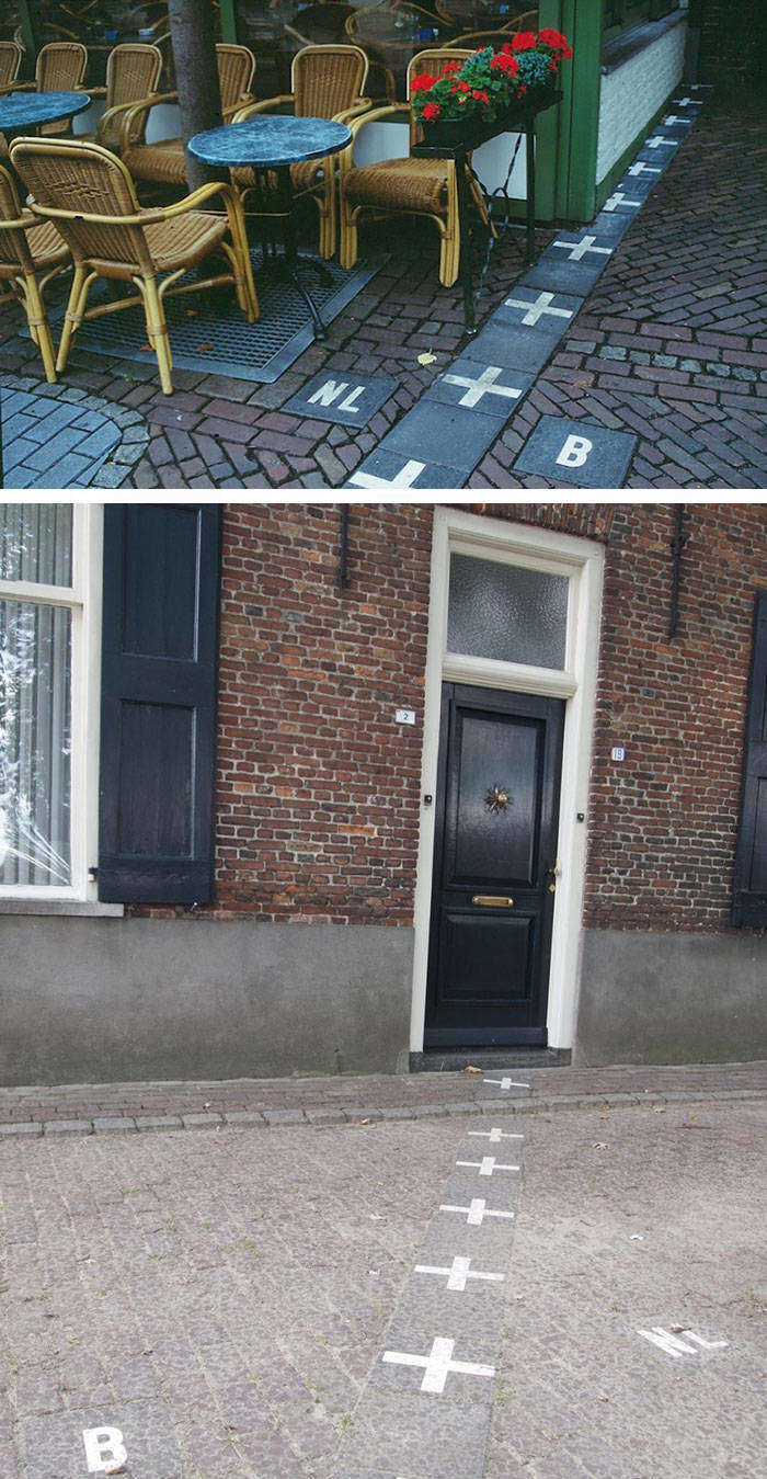
Netherlands and Belgium


Poland and Ukraine


Haiti and The Dominican Republic, which have very different environmental protection laws


Zipline that connects Spain and Portugal


USA and Mexico


Macau and mainland China. Macau drives on the left side of the road, mainland China on the right. This is their solution for when you cross the border​.


Argentina, Brazil and Paraguay


Bolivia and Brasil


USA and Mexico


Denmark and Sweden


Germany, The Netherlands and Belgium


USA and Canada


Sweden and Norway


A woman in Lithuania speaking to her friends in Belarus


Germany and Czech Republic


Germany and Czech Republic


Egypt and Israel


German, Poland and Czech


Friday, August 14, 2015

Fascinating Maps

1. This map shows the world divided into 7 sections (each with a distinct color) with each section containing 1 billion people.

2. This map shows (in white) where 98 percent of Australia's population lives.

3. It may not 
come as a surprise but more people live inside the circle than outside of it. 

4. This map shows what is on the other side of the world from where you are standing.  For the most part it will probably be water.

5. Apparently you can't get Big Macs everywhere.  This map shows (in red) the countries that have McDonalds.

6. This map shows the countries (in blue) where people drive on the left side of the road.

7. This map shows countries (in white) that England has never invaded.  There are only 22 of them.

8. The line in this map shows all of the world's Internet connections in 1969.

9. This map shows the countries that heavily restricted Internet access in 2013.

10. This map shows (in red) countries that were all Communist at one point in time.

11. This map shows (in red) the countries that don't use the metric system.

12. This map shows (in blue) places where Google street view is available.

13. This map shows (in green) all the landlocked countries of the world.

14. And this is what the world would look like if all the countries with coast lines sank.

15. This is a map of the all the rivers in the United States.

16. And these are all the rivers that feed into the Mississippi River.

17. This is a map of the highest paid public employees in the United States.

18. This map shows how much space the United States would occupy on the moon.